We came up with the initial design for the 10-acre Project Lombong after a couple months of deliberation. The first thing that we implemented was earth-shaping for water and access. The heavy machines would need to do their work before we start planting. After that it would be difficult for the machines to maneuver freely.
Lay of the Land
The highest point of the land is on the eastern corner at 49m elevation (top center on map below). From there, it slopes down to the west, ending at the western corner at 26m elevation (bottom left on map). The slope is mild: averaging about 6 degrees, with a maximum of 11.3 degrees. The shape of the slope is a ridge; there are no valleys.
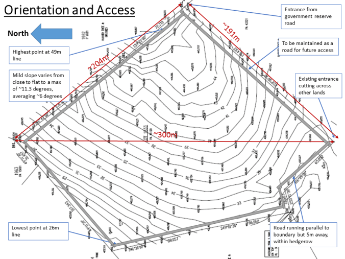
We planned for roads to run along the boundary. They will be 5m from the edge to allow space for a hedgerow. Due to the heavy rains here, the earthworks contractor double-cambered the roads (highest point in the middle, sloping down to the sides) to help drainage. Some of the water will be diverted into swales to soak into the soil.

After digging the mudtrack, Kevin’s 4-wheel drive got stuck on the road once during a rain. He then decided to put gravel on the roads to help with traction. We were very lucky that the earthworks contractor found some spots on the land with red gravel. Those gravel will be excavated and spread on the sloping roads. These spots would then become ponds. That would save lots of money. Local experience is so important! Continue reading

